
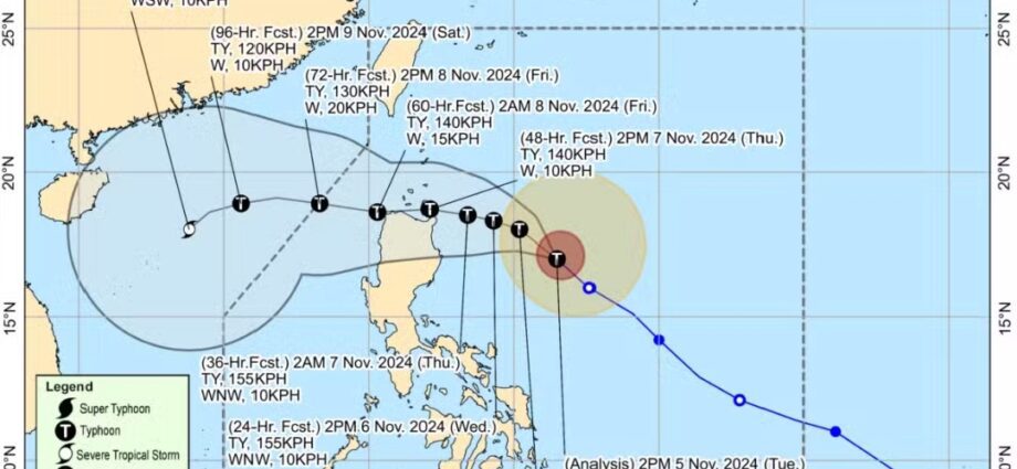
TYPHOON Marce (international name: Yinxing) is expected to intensify as it nears the Babuyan Islands or Cagayan, with landfall anticipated on Thursday afternoon or evening, according to the Philippine Atmospheric, Geophysical and Astronomical Services Administration (Pagasa) on Tuesday.
In its 5 p.m. weather bulletin, Pagasa reported that Marce “may reach its peak intensity before making landfall.”
Marce was last observed 480 kilometers east of Echague in Isabela, with maximum sustained winds of 130 kilometers per hour (kph) and gustiness reaching up to 160 kph. The storm was moving northwest at 25 kph.
In an earlier advisory, Marce had sustained winds of 120 kph and gustiness of up to 150 kph, showing a slight intensification.
Pagasa forecasts that Marce will move generally west-northwest through Wednesday (November 6) before slowing down and turning westward over the Philippine Sea, east of Extreme Northern Luzon.