
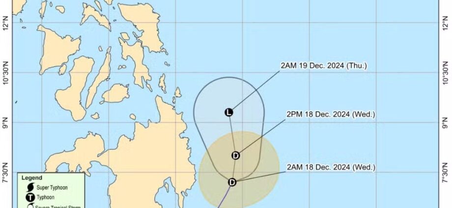
MANILA, Philippines — Tropical Depression Querubin continues to sustain its strength as it hovers over the waters east of Mindanao, the Philippine Atmospheric, Geophysical, and Astronomical Services Administration (Pagasa) reported early Wednesday.
As of 5:00 a.m., Querubin was located approximately 230 kilometers east of Davao City or 205 kilometers east of Tagum City, Davao del Norte. It is moving north-northwest at 10 kilometers per hour (kph), with maximum sustained winds of 45 kph and gusts reaching up to 55 kph, Pagasa said.
Tropical Cyclone Warning in Effect
Tropical Cyclone Wind Signal No. 1 remains hoisted over Davao Oriental, where residents can expect winds of 39 to 61 kph and intermittent rains within the next 36 hours.
“Maulan na panahon na may kasamang pagbugso ng hangin ang inaasahan,” Pagasa weather specialist Aldczar Aurelio said.
Forecast and Impacts
Querubin is projected to move generally north-northeast or northward over the waters east of Mindanao within the next 24 hours. Pagasa predicts that the tropical depression will weaken into a “remnant low-pressure area” during this time frame.
No gale warnings have been raised over any of the country’s seaboards for Wednesday, Pagasa added.
Residents in affected areas are advised to stay updated on weather bulletins and prepare for possible heavy rainfall and gusty winds.